


Koronjää, 5 km, Circle Trail
Available all year round. In winter the trail is dangerously slippery and ice grippers are needed.
Duration 2‒3 hours.
Category:  demanding trail due to the altitude differences
The only trail in Finland where you can admire gorgeous frozen waterfalls in winter and beautiful river scenery in summer, and always sense the presence of the magnificent cliffs.
The trail runs along a former horse road, and there are information boards on the area's logging history along the trail. The trail takes hikers onto the top of cliffs with magnificent views, and to the bottom of the canyon.
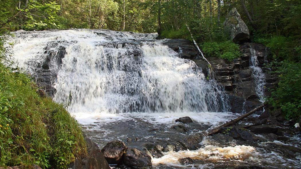
Along the trail, hikers will get a chance to admire the three largest frozen waterfalls at Korouoma, which are called Jaska Jokunen (Charlie Brown), Ruskea virta (the Brown River) and Mammuttiputous (the Mammoth Fall).
The lush vegetation and the river bubbling in the canyon in summer, the autumn colours, and the gorgeous frozen waterfalls in winter are definitely sights worth seeing!
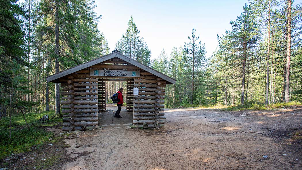
Starting Point
Saukkovaara parking area.
Hiking Structures
The Hannunkallio lookout point with railings and wooden benches. Rope railings at the steepest parts of the trail to make the going easier. The Kanjonilaavu lean-to shelter and campfire sites.
Sights
Hannunkallio lookout point, River Korojoki, flood meadows, the canyon and its rock walls. Magnificent frozen waterfalls in winter. Read more about the sights in Korouoma.
Trail Description
Trail marking: wooden poles with green ribbons and yellow reflectors.
Recommended direction: clockwise.
The trail starts at the Saukkovaara parking area and runs to the Hannunkallio lookout point. From there, it descends to the banks of the River Korojoki, where you can admire three large frozen waterfalls in the winter, which are Jaska Jokunen (Charlie Brown), Mammuttiputous (the Mammoth Fall) and Ruskea virta (the Brown River). The trail then ascends, via the Kanjonilaavu lean-to shelter, back to Saukkovaara.


Piippukallion pihaus Trail, 5 km, Circle Trail
Only available in summer (June-October).
Travel time: 3-4 hours.
Category: +++ very demanding due to the altitude differences, rocks and roots.
Piippukallion pihaus Trail offers a varied feast for the eye and slopes that will make your pulse race. From the slopes high up, there is a view towards the opposite rock and block field slopes and you can catch glimpses of River Korojoki, which flows in the canyon.
It is very important to follow the trail marks, as the trail cannot yet be seen in the terrain for a distance of about 1.5 kilometres, which runs up from the Kanjonilaavut lean-to shelters onto a former horse road and further on to the Piippukallio lean-to shelter. From each trail mark, you will always see the next trail mark.
Starting Point
Saukkovaara starting point.
Trail Description
Piippukallion pihaus Trail starts from the Saukkovaara parking area and runs to the Kanjonilaavut campfire site. From there, the trail continues along the bank of River Korojoki and ascends, along the former horse road, to the Piippukallio lean-to shelter. Next, the trail descends, via the lookout points, to the shore of River Korojoki. The trail then ascends, via the Kanjonilaavut lean-to shelters, back to Saukkovaara.
It is very important to follow the trail marks, as the trail cannot yet be seen in the terrain for a distance of about 1.5 kilometres, which runs up from the Kanjonilaavut lean-to shelters onto a former horse road and further on to the Piippukallio lean-to shelter. From each trail mark, you will always see the next trail mark.
Hiking Structures
Kanjonilaavut and Piippukallio lean-to shelters.
Sights
River Korojoki, flood meadows, rugged rock walls and views from Piippukallio and elsewhere along the trail across Korouoma Canyon.
Trail marking
Green painted markings on trees.
Recommended direction: anti-clockwise.


Korouoma Hiking Trail, 20 km / Direction
The trail runs through the majestic landscape of the Korouoma Canyon with its cliffs and eskers.
When the ground is unfrozen.
Duration about 1‒2 days.
Category:  intermediate
Starting Point
Saukkovaara or Lapiosalmi (Lastenlampi).
Hiking Structures
Six lean-to shelters, one open wilderness hut, one day-use hut and one rental hut.
Sights
River Korojoki, flood meadows, the canyon with its rock walls, patches of herb-rich forest, eskers at the south-eastern corner and the crystal-clear lakes. Read more about the sights in Korouoma.
Trail Description
Trail marking: orange paint on trees.
The trail starts at Saukkovaara, descends into the canyon, and then follows the River Korojoki upstream. There are several maintained flood meadows along the trail. Towards the end, the trail climbs onto the eskers, offering splendid views of crystal-clear lakes.
Please note
The hiking route has been shortened on June 9, 2021, when the Pirunkirkko bridge has been demolished. In the future, you can hike the Lapiosalmi-Saukkovaara hiking trail.
Cross-country Skiing Trails
- During winter visitors can either ski or walk with snowshoes through the valley. During early spring a maintenance skiing trail is made by skiers from Saukkovaara Hill to Pajupuro open wilderness hut. During the middle of winter Korouoma has some of Finland's finest ice climbing destinations.
Korouoma Brochure

Pdf 5.3 Mb (julkaisut.metsa.fi)
A bilingual, Finnish-English version (Pdf 5.5 MB, publications.metsa.fi) of the Korouoma brochure has also been made.

