Oulanka National Park Trails

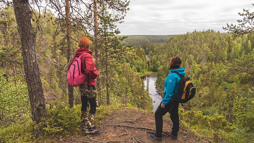
You can explore the gorgeous national landscape of the Oulanka National Park on foot, by canoe, by bike, on skis or by snowshoes. The national park offers excellent hiking opportunities, ranging from short day-trip trails to the 82-km-long Karhunkierros Trail, which is one of the most popular hiking trails in Finland.
Choose the trail that suits you best and hike to the gushing rapids, the beautiful flood meadows, the winter forests and the rugged landscape. Discover your own Oulanka!
Easy Trails
Könkään kuohu Trail, 100 m / each way, accessible to all

Available when the ground is unfrozen (June-September). No winter maintenance.
Travel time: 15 minutes
Category:  easy
easy  accessible nature trail / wheelchair trail
Starting point: The parking area for the Könkään kuohu Trail. No winter maintenance.
Description of the Könkään kuohu Trail
Napapiirin nopia Trail, 500 m each way

Available when the ground is unfrozen (June‒September). No winter maintenance.
Travel time: 30 minutes‒1 hour.
Category:  easy
easy  accessible nature trail / wheelchair trail
Starting point: The starting point for the Karhunkierros Trail at Hautajärvi. The trail is part of Karhunkierros.
Description of the Napapiirin nopia Trail
Kiutaköngäs Trail, 1 km each way

Available all year round. No winter maintenance.
Travel time: 1 hour
Category:  easy
easy
Starting point: Oulanka Visitor Centre
Description of the Kiutaköngäs Trail
Other Hiking Trails, under 10 km
Hiiden hurmos Trail, 5 km, Circle Trail

Available all year round. In winter snowshoes might be needed. No winter maintenance.
Travel time: 2‒3 hours
Category:  intermediate
Starting point: Oulanka Visitor Centre
Description of the Hiiden hurmos Trail
Rytikönkään reissu trail, 5‒7 km, Circle Trail

Available when the ground is unfrozen (June‒October). No winter maintenance.
Travel time: 2-3 hours
Category:  easy
easy
Starting point: The parking area of the Oulanka Camping Ground (no winter maintenance). You can also leave your car to the parking area of Oulanka Visitor Centre.
Description of the Rytikönkään reissu Trail
Kanjonin kurkkaus Trail, 6 km, Circle Trail

Available when the ground is unfrozen (June‒October). No winter maintenance.
Travel time: 2‒3 hours
Category:  intermediate
Starting point: The Savilampi parking area at the end of a forest road that branches off from Teeriahontie Road (no winter maintenance).
Description of the Kanjonin kurkkaus Trail
Könkään keino Trail, 8 km, Circle Trail

Available when the ground is unfrozen. No winter maintenance.
Travel time: 3‒4 hours
Category:  easy
easy  intermediate
Starting point: Oulanka Visitor Centre
Description of the Könkään keino Trail
Other Hiking Trails, over 10 km
Pieni Karhunkierros Trail, 12 km, Circle Trail

Available all year round. In winter snowshoes might be needed. No winter maintenance.
Travel time: 4‒6 hours
Category:  intermediate
Starting point: Village of Juuma (Juumantie 133, Kuusamo)
Description of The Pieni Karhunkierros
Keroharjun kuiskaus Trail, 17 km each way

Available when the ground is unfrozen (June‒September). No winter maintenance.
Travel time: 1 day
Category:  intermediate
Starting and ending points: Harjulammentie Road at Liikasenvaara (no winter maintenance) and Niitselyksentie Road at Hautajärvi. The River Niitselysjoki is crossed by using a cable boat.
Description of the Keroharjun kuiskaus Trail
Karhunkierros Trail, 82 km each way
Available when the ground is unfrozen (June‒October). No winter maintenance.
Travel time: 4 days
Category:  intermediate
Starting point: Several starting points (Hautajärvi, Ristikallio/Sallantie Road, Juuma, Ruka)
Website of the Karhunkierros Trail
Canoeing Routes
Mataraniemi – Jäkälämutka, 25 km

Available during the period of unfrozen waters (June‒October). Suitable for beginners and families with children.
Travel time: 5‒7 hours
Category:  easy
easy
Starting point: The parking area for the Könkään kuohu Trail, Mataraniemi
Trail description: Canoeing Route Mataraniemi – Jäkälämutka
Savilampi – Oulanka Visitor Centre, 13 km

Available during the period of unfrozen waters (June‒October). Suitable for experienced canoeists.
Travel time: 2‒4 hours
Category:  intermediate
  demanding
Rapids scale: I‒IV
Starting point: The Savilampi parking area, on the border of Salla and Kuusamo, at the end of a forest road.
Trail description: Canoeing Route Savilampi ‒ Oulanka Visitor Centre
Biking Trails
Oulanka Visitor Centre - Taivalköngäs, 9 km each way

Available when the ground is unfrozen (June‒October). No winter maintenance.
Travel time: 3‒4 hours
Category:  demanding
Starting point: Oulanka Visitor Centre
Description of the Biking Trail
Oulanka Wilderness Trail: Oulanka Visitor Centre ‒ Juuma, 26 km each way

Available from mid-February to April
Travel time: 4 hours ‒ 1 day
Category: Demanding trail demanding
Starting point: Oulanka Visitor Centre or Juuma
Description of the Oulanka Wilderness Trail
Skiing Trails
Oulanka Wilderness Trail, 26 km each way

Available from mid-February to April
Travel time: 1‒2 days
Category:  demanding
Starting point: Oulanka Visitor Centre or Juuma
Description of the Oulanka Wilderness Trail
Snowshoe Trails
Hiiden hurmos Trail, 5 km / Circle Trail

This trail is a hiking trail in summer and a snowshoe trail in winter
Travel time: 2‒3 hours
Category:  intermediate
Starting point: Oulanka Visitor Centre
Trail description: Hiiden hurmos Trail
Pieni Karhunkierros Trail, 12 km / Circle Trail

This trail is a hiking trail in summer and a snowshoe trail in winter
Travel time: 4‒6 hours
Category:  intermediate
Starting point: Juuma (Juumantie 133, Kuusamo)
Description of the Pieni Karhunkierros Trail
Oulanka Wilderness Trail, 26 km each way

Available from mid-February to April
Travel time: 1‒2 days
Category:  demanding
Starting point: Oulanka Visitor Centre or Juuma
Description of the Oulanka Wilderness Trail
Other Hiking Trails close to Oulanka and Ruka
Check for Warnings
 When wildfire warnings (en.ilmatieteenlaitos.fi) are in effect, fire is only allowed at covered campfire sites that have a flue. A fire can be also lit in fireplaces at wilderness and other huts. Always use extreme caution when handling fire. The one who lights a fire is always responsible for its safe use. Please note, that making fire at these campfire sites can be banned locally.


