Neitvuori-Luonteri Area Trails
Hiking Trails
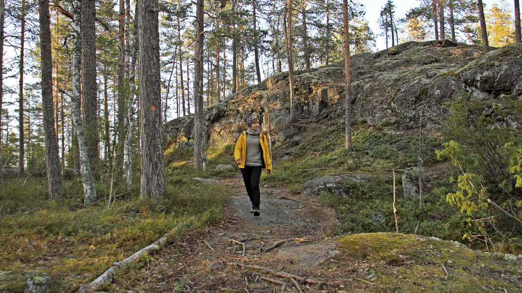
Neitvuori has a marked and signed hiking trail "Hiijje silimukka", which is approximately 4 km in length. Visitors can admire the beautiful landscape of forested hills and labyrinthine Saimaa, home to the ringed seal, from the top of Neitvuori. From Hiijje Silimukka, you can access the trails of Hiidenmaa (a total of 55 km), which are marked red in the field. Hiidenmaan retket ry hiking association is responsible for the Hiidenmaa trails, and they are shown on the Hiidenmaa Trails map.

Starting Points for Trails
You can reach the Neitvuori, Hiijje silimukka and Hiidenmaa trails from the parking area next to the Hiidenmaa farm.
Trails
Hiijje silimukka 3.9 km. The trail can be cut in half for a shorter 2.6 km hike. The locations of scenic lookouts are marked on the information map. Information maps (PDF file, 1.4 Mb, julkaisut.metsa.fi) in the parking area and at trail intersections. The trail passes through varying forest terrain, on rock slopes and over the highest points of South Savo. The trail is marked by orange paint spots.
Services: Neitvuori parking area nearby Hiidenlahti ferry pier. Lean-to, dry toilet and campfire site about a kilometre from the parking area.
Connection to other trails: The trail is connected to the Hiidenmaa trails.
Map: Hiijje silimukka hiking trail (PDF file, 1.4 Mb, julkaisut.metsa.fi)

Hiidenkierros circle trail, approximately 13 km, starts from the Neitvuori parking area.
The hike begins with the Hiijje silimukka trail, which turns off toward Hiidenkota at Harvalainen pond. Outside the Neitvuori route, the trail is marked by red. There are several route alternatives, which are shown on the Hiidenmaa Trails map. The trail passes through demanding terrain. The distance from the Neitvuori parking area to Hiidenkota is approximately 5.5 km.
From Hiidenkota, the trail continues towards the south. It is 700 metres to the Riihijärvi parking area. When leaving the parking area, the trail follows a forest road for a while, but soon reaches the shore of Lake Riihijärvi, where visitors can also swim. However, there is no official swimming beach. The trail takes you from the Riihijärvi shore east of Kaatronlampi pond to the Myllyjoki intersection, to which it is 2.7 km from the Riihijärvi parking area. From the intersection, the Hiidenkierros circle trail continues to the left to the Kotkanpesänvuori observation point. 2.2 km after the Myllyjoki intersection, there is an intersection, from which it is 1.4 km to the scenic lookout at Siikavesi. From here, it is a 0.9 km descent to the Neitvuori campfire site. Alternative routes can also be found on the Hiidenmaan polut trail map. Hiidenmaan retket ry hiking association is responsible for the trail.
Services: In addition to the Neitvuori area, Hiidenkota and its campfire sites and swimming facilities as well as the Riihijärvi parking area and Riihijärvi swimming facilities. There is no official beach in the area.
Sights: In addition to Neitvuori, other beautiful scenic lookouts.
Connection to other trails: Pien-Hiidenkierros (approx. 5 km) circle trail before reaching Hiidenkota. At Kontiosuo there is also a connection to the Metsänväkitaipale trail, along which visitors can hike all the way to Siikakoski or the village of Koikkala.
Map: Hiidenmaan polut trail map
Boating and Canoeing Routes
Paddling circle route (approx. 54 km) in the Luonteri archipelago is part of Veskansan reitit paddling routes. The paddling route winds its way through the peaceful archipelago, whose beauty is further enhanced by the crystal clear waters.
You can set out from Anttola harbour, Kuparovirta or Lietvesi Bridge at the boat landing. When leaving Anttola, the nearest excursion harbour is about 8 km from Korvensaari. In this case, the paddling route follows a counterclockwise direction. When paddling in a clockwise direction, the first rest stop is at the foot of Neitvuori, to which there is a 1.5 km detour from the actual route. You’ll need at least 2-3 days to get to know the area. There is a portage across an isthmus (less than 100 m) at Hakolahti.
Services: Anttola harbour and services, Makutsaari lean-to shelter and dry toilet as well as the Karihiekka and Korvensaari excursion harbours. For more information on tourism services in the area, refer to, for example, the Veskansan reitit map. Neitvuori campfire site with dry toilets, Neitvuori parking area and Hiidenlahti ferry.
Sights: Neitvuori
Connection to other routes: The paddling circle route is linked to other Veskansa routes: From both sides of Ihantsalo island, you can paddle to Lietvesi, which can also be reached via Väätämönsalmi on a longer route.
Map: Veskansan reitit map

Biking Trails
Once outside the city limits, the Mikkeli-Neitvuori cycling route, approx. 40 km, follows an idyllic old village road to the foot of Neitvuori. The village road is paved. Cycling takes more time per kilometre due to the hilly terrain. The cycling route is marked by a brown square with a white bicycle symbol on it.
Services: Neitvuori campfire site with dry toilets (1 km from parking area). The nearest banks, service stations, cafés and other services are located in Anttola (anttola.fi), which is 22 km from Neitvuori. The most comprehensive services are available in Mikkeli.
Sights: Neitvuori
