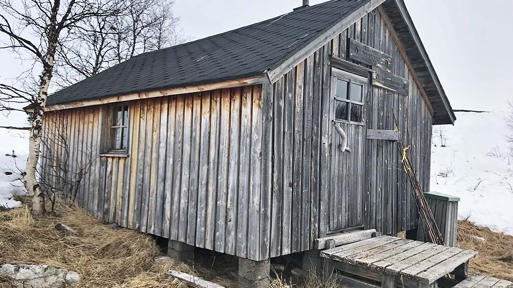
- Top Natural Attractions
-
National Parks
- Archipelago
- Bothnian Bay
- Bothnian Sea
- Ekenäs Archipelago
- Gulf of Finland
- Helvetinjärvi
- Hiidenportti
- Hossa
- Isojärvi
- Kauhaneva-Pohjankangas
- Koli
- Kolovesi
- Kurjenrahka
- Lauhanvuori
- Leivonmäki
- Lemmenjoki
- Liesjärvi
- Linnansaari
- Nuuksio
- Oulanka
- Pallas-Yllästunturi
- Patvinsuo
- Petkeljärvi
- Puurijärvi and Isosuo
- Pyhä-Häkki
- Pyhä-Luosto
- Päijänne
- Repovesi
- Riisitunturi
- Rokua
- Salamajärvi
- Seitseminen
- Sipoonkorpi
- Southern Konnevesi
- Syöte
- Teijo
- Tiilikkajärvi
- Torronsuo
- Urho Kekkonen National Park
- Valkmusa
- World Heritage Sites
- National Hiking Areas
- Wilderness Areas
-
Other Nature Sites
- Aulanko
- Auttiköngäs
- Dagmar Park
- Friendship Park
- Hepoköngäs
- Hetta Area
- Hämeenkangas
- Iivaara
- Ilmakkiaapa
- Kevo
- Kivitunturi
- Korouoma
- Laajalahti
- Langinkoski
- Luiro Mires
- Malla
- Martimoaapa
- Näränkä
- Porkkala
- Punkaharju
- Rahja
- Sallatunturi Area
- Siikalahti Nature Reserve
- Simojärvi and Soppana
- Sompio
- Teuravuoma - Kivijärvenvuoma
- Valtavaara-Pyhävaara
- Viiankiaapa
- Öjen
- Hiking Trails
- Huts
-
Historical Sites
- Hunting Pits on Jyppyrä Hill
- Kajaani Castle Ruins
- Kurjenpolvi Graveyard
- Kuusisto Bishop’s Castle Ruins
- Langinkoski Imperial Fishing Lodge
- Pakasaivo and the Kirkkopahta Seida Rock
- Rapola Hill Fort
- Raseborg Castle Ruin
- Seili Island
- The Grounds of Kaapin Jouni
- Vallisaari
- Äkässaivo and Seitapahta
- Örö Fortress Island
- Nature Centres
- Accessible Destinations
- Geoparks
Salvasjärvi Open Wilderness Hut
-
Salvasjärvi Open Wilderness Hut. Photo: Marko Huusko.
-
Salvasjärvi Open Wilderness Hut. Photo: Marko Huusko.
-
Salvasjärvi Open Wilderness Hut. Photo: Marko Huusko.
-
Salvasjärvi Open Wilderness Hut. Photo: Jussi Pusa.
Type
Open wilderness hut for 6 persons
Location, Maps and Description
Northern Lapland Region, Municipality of Enontekiö, Tarvantovaara Wilderness Area
Salvasjärvi, coordinates: Euref-Fin (~ WGS84) lat: 68° 40.8035' lon: 23° 02.2884' ETRS-TM35FIN: N: 7623864 E: 339342
Hut is located near the border of Norway, on the eastern shore of Salvasjärvi Lake which is located northwest of Salvastunturi Fell. Hut is located along the Hetta-Kilpisjärvi snowmobile trail.
Tarvantovaara Wilderness Area's map
Other maps
Excursionmap.fi
Facilities
A stove. A dry toilet and a woodshed outside the hut.
Notices
Pets are permitted in the hut, but only in case that other visitors agree with it.
Visitors must come prepared with warm clothing, food, drink, maps, compass, orienteering skills and matches. Fog or storms can form in just a few hours. Take also your own toilet paper.
Waste Management
Metsähallitus follows the principles of litter-free hiking. Visitors are adviced to bring their own waste out of the area. Recycling points can be found at Yllästunturi, Pallastunturi and Fell Lapland Visitor Centre. Read more about Hiking without littering.
Maintenance and Management
Metsähallitus, Parks & Wildlife Finland. For more information contact Fell Lapland Visitor Centre tel. int. +358 20 639 7950.